Survey area at the foot of the Castle mound of Hostalric
Hostalric
Hostalric
- Multi-phase archaeological site on the flanks of the mound of the Castle of Hostalric (Map)
- Magnetic prospection
- Complementary GPR investigation by SOT Prospecció, Barcelona
- Total area: 7.8 ha
- 2 survey days
- Equipment: LEA MAX with 7 Förster fluxgate gradiometers FEREX CON650
- Digital Terrain Model based on GPS measurements for magnetic prospection
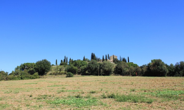
Survey area and Castle of Hostalric
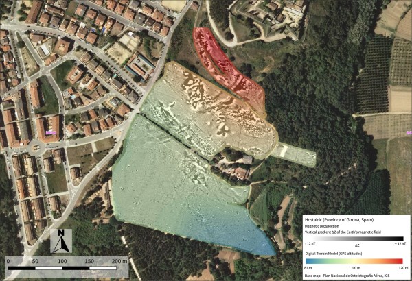
Hostalric magnetic data
Superposition of magnetic data and Digital Terrain Model at the site of Hostalric