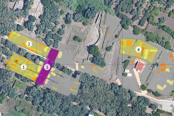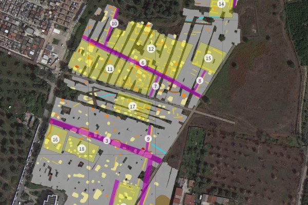
Magnetic prospection was carried out in the ancient cities of Medma and Tauriani in Calabria. Medma, a Locrian colony founded in the 7th century BC and abandoned in the 4th century BC, and Tauriani, an Italic settlement inhabited from pre-Greek times until the 10th century AD, represent two key sites for understanding the region’s long-term urban development.
During a three-day campaign, approximately 10 hectares were surveyed using a seven-sensor gradiometer array with RTK positioning. At Medma, the data indicate a Hippodamian street grid, densely built insulae, and larger building complexes, although modern disturbance affects parts of the interpretation. At Tauriani, despite limited and fragmented survey areas, the measurements confirm a regular urban layout with rectangular buildings and paved roads.
Overall, the results significantly enhance the understanding of both ancient cities and provide a strong basis for further geophysical surveys and targeted archaeological investigations.