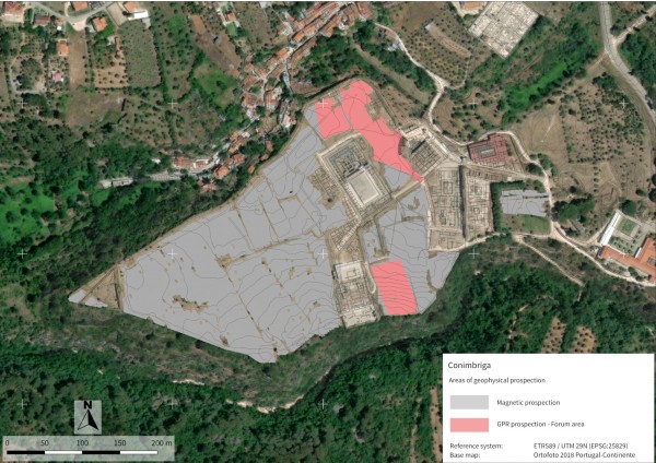
The first large-scale geophysical survey in the Roman city of Conímbriga was carried out by cmp in cooperation with SOT Prospecció Arqueològica. As one of Portugal’s most important archaeological sites and a National Monument, Conímbriga was investigated using both magnetic and ground-penetrating radar methods across large parts of the walled city. Magnetic measurements covered 7.32 hectares, while 0.9 hectares were examined using georadar, and the entire fieldwork was completed in just four days, despite the complex conditions at the site.
Challenging geological factors, including porous travertine and limestone, contributed to noisy data. Nevertheless, the survey made it possible to identify monumental building complexes, urban quarters, and ancient infrastructure. The interpretation is based on careful plausibility assessments and existing archaeological knowledge and represents a first step toward understanding the city’s subsurface remains, providing a strong foundation for future works.
The report is open access, and a detailed publication of the results is forthcoming under the title Conimbriga: A Comprehensive Geophysical Survey and the Reconstruction of the Town’s Plan, to appear in Open Archaeology (2026).