Artaxata in the Ararat plain
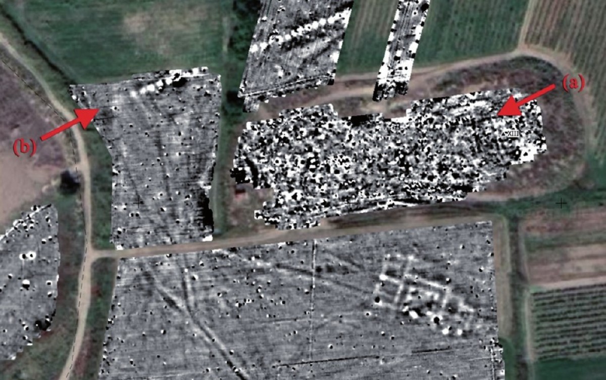
As part of the Armenian-German Artaxata Project, three geophysical survey campaigns carried out between 2018 and 2024 investigated the ancient city of Artaxata and its surroundings. Large-scale magnetic surveys focused in particular on tracing the south-western city wall and determining the extent of the Eastern and Southern Lower Cities, with a total surveyed area of 53 hectares.
The interpretation of the magnetic data revealed numerous potential archaeological features, including rectangular wall foundations, pits, ditches, paths, and fireplaces, indicating a complex and densely structured urban landscape. These results are essential for reconstructing the urban layout and defensive architecture of Artaxata and provide a strong basis for further archaeological research.

See also:
Lichtenberger, A., Meyer, C. & Zardaryan, M. H. (2019). Report on the 2018 Magnetic Prospection at Artaxata/Artashat in Armenia. Archäologischer Anzeiger 2019/2
Lichtenberger, A., Meyer, C., Schreiber, T., & Zardaryan, M. H. (2022). Magnetic prospection in the eastern lower city of Artashat-Artaxata in the Ararat Plain of Armenia. Electrum, 29, 109-125.
Gabriel, C., Gyulamiryan, H. A., Lichtenberger, A., Meyer, C., Schreiber, T., & Zardaryan, M. H. (2025). Geophysical Prospection of the South-Western Quarter of the Hellenistic Capital Artaxata in the Ararat Plain (Lusarat, Ararat Province, Armenia): The South-West Quarter, City Walls and an Early Christian Church. Open Archaeology, 11(1), 20250042.