For the first time, the north-western Lower Town of Nineveh, north of Tell Koujunjik in Mosul (Iraq), was systematically investigated on a large scale using magnetic prospection. Covering approximately 29.5 hectares, the survey focused on settlement patterns and building history during the Neo-Assyrian period, when Nineveh developed into a major imperial capital between the 9th and 7th centuries BC (ca. 911–612 BC). The magnetic data revealed numerous potential archaeological features, including transport routes, foundations, and traces of burnt features. Distinct building patterns across the surveyed sectors indicate different functional zones, such as residential areas, palatial complexes, and public spaces. The eastern sector, likely aligned with the Royal Road, displayed a particularly dense and complex architectural layout, while evidence for water management was limited and mainly concentrated near the Koujunjik area. Overall, the survey provides important new insights into the urban structure and architectural development of Nineveh’s Lower Town during the Neo-Assyrian period.
North-western Lower Town of Nineveh
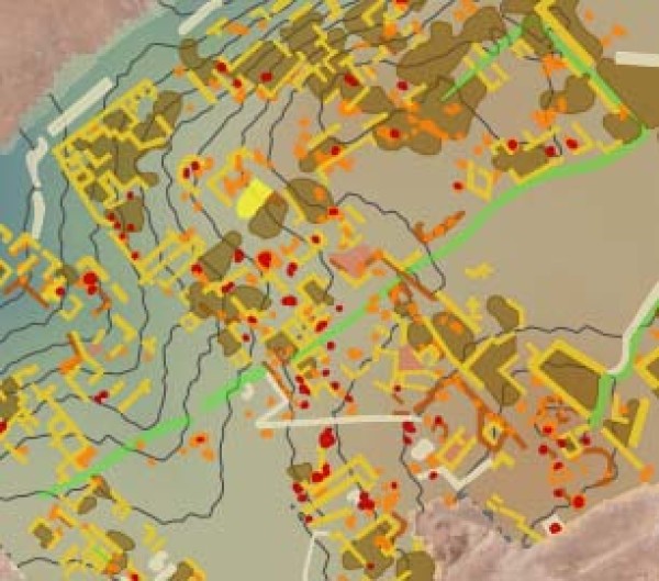
Section of the interpretation map projected on the DEM